German Wine Map
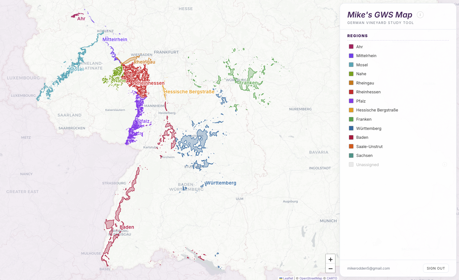
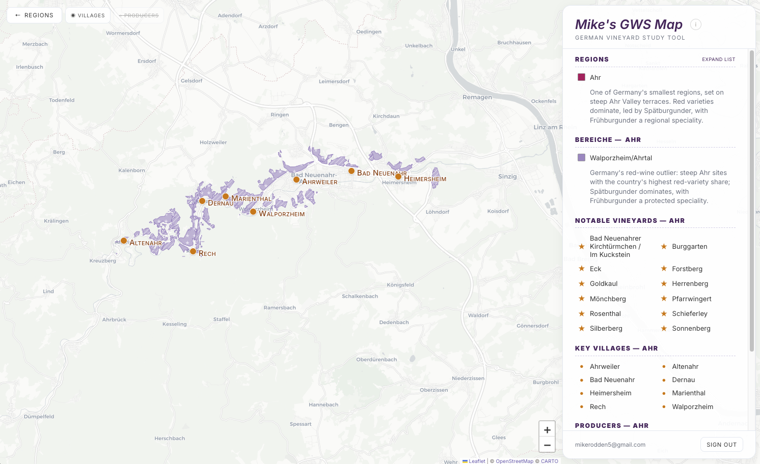
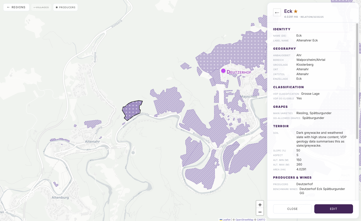
An interactive map of Germany's wine regions built as a study tool for the German Wine Scholar program. The map covers every Anbaugebiet down to individual vineyard polygons, with the ability to drill from region to Bereich to Einzellage. Vineyard data is being manually researched, verified, and filled in as part of my studies.
The goal is to learn the German wine landscape in depth by actually building the reference material myself, rather than relying on existing resources. There may be errors or incomplete data. If you spot something wrong or would like access to collaborate, reach out via LinkedIn.
Built with
Study progress
18% of Bereiche and vineyards reviewed
How to use
Click any region in the sidebar to zoom in and see its vineyards. Click a Bereich to zoom further. Click any vineyard polygon on the map to view its details. Sign in to edit vineyard data.
Map legend
Data sources
Vineyard boundary data starts from OpenStreetMap and custom polygons, then is manually verified and enriched using the following sources: